Map Files #
The Map Files tab is used to upload, manage, and download the maps used by your fleet.
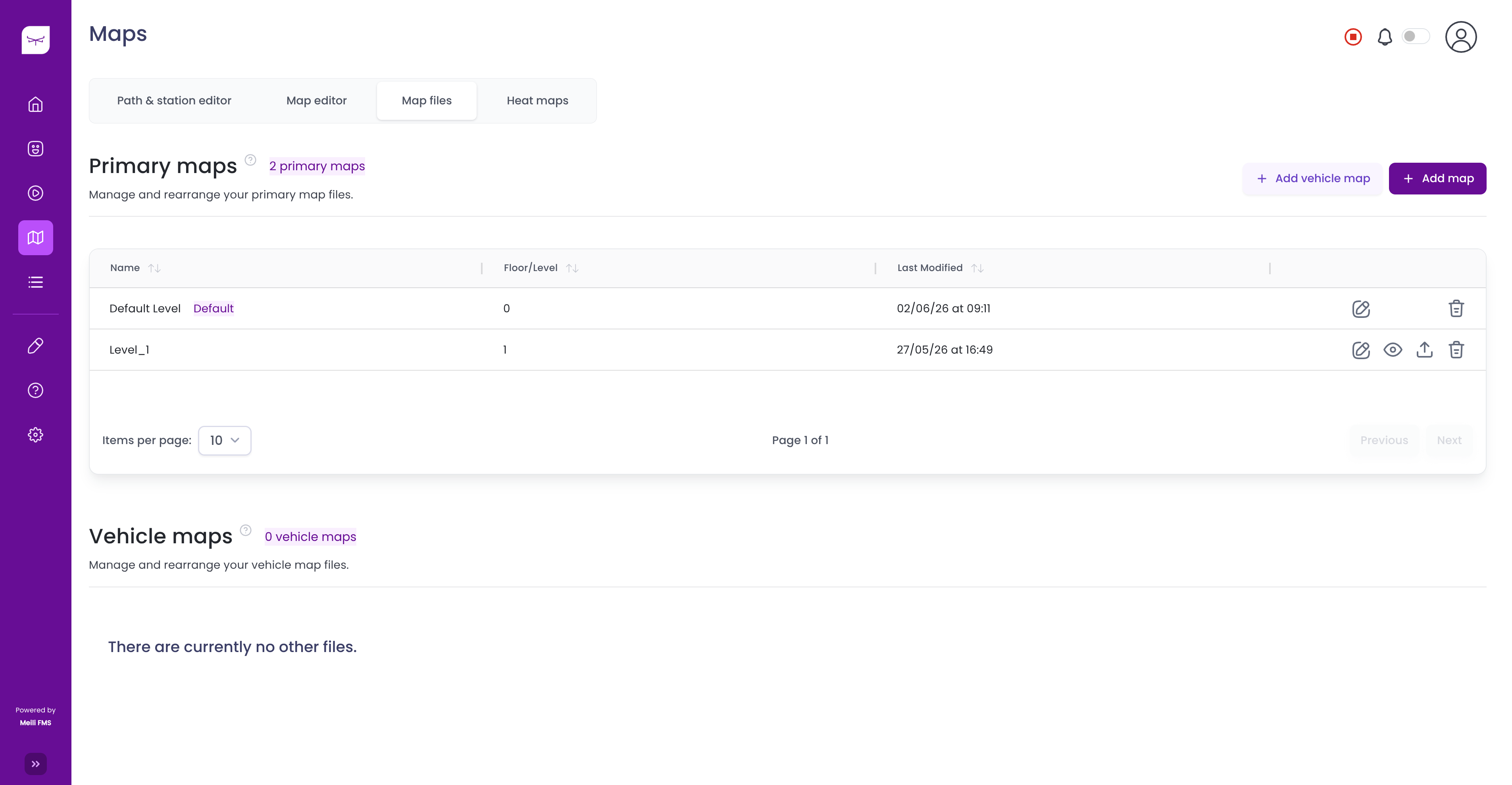
Maps are divided into two categories:
- Primary maps – The main maps used by the fleet. One map can be designated as the default map.
- Vehicle maps – Maps that are associated with specific vehicles.
To upload a new primary map, click Add Map. To upload a map for a specific vehicle, click Add Vehicle Map.
For each map, the table displays the following information:
- Name – The name of the map.
- Floor/Level – The floor or level represented by the map.
- Last Modified – The date and time the map was last updated.
The available actions depend on the map type and include:
- Edit – Rename or modify the map details.
- Preview – Open the map for viewing.
- Download – Download the map file.
- Delete – Remove the map from the system.
If multiple pages of maps are available, use the pagination controls at the bottom of the page to navigate between them.
Upload a map #
The map upload process consists of three steps.
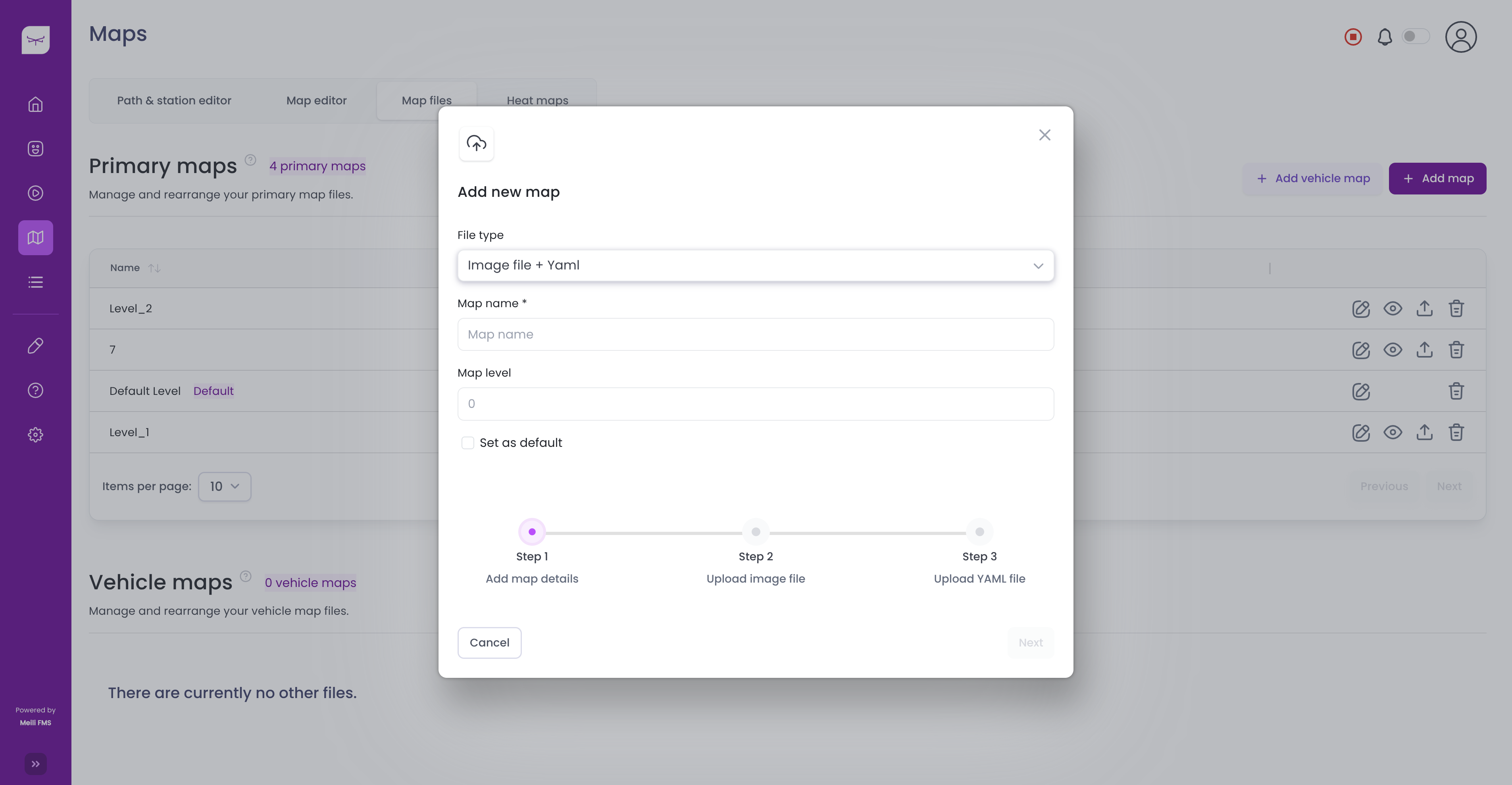
Step 1 – Add map details #
To upload a new map:
- Click Add Map.
- Select the File type.
- Enter a Map name.
- Specify the Map level.
- (Optional) Enable Set as default if you want to make this the default map.
- Click Next.
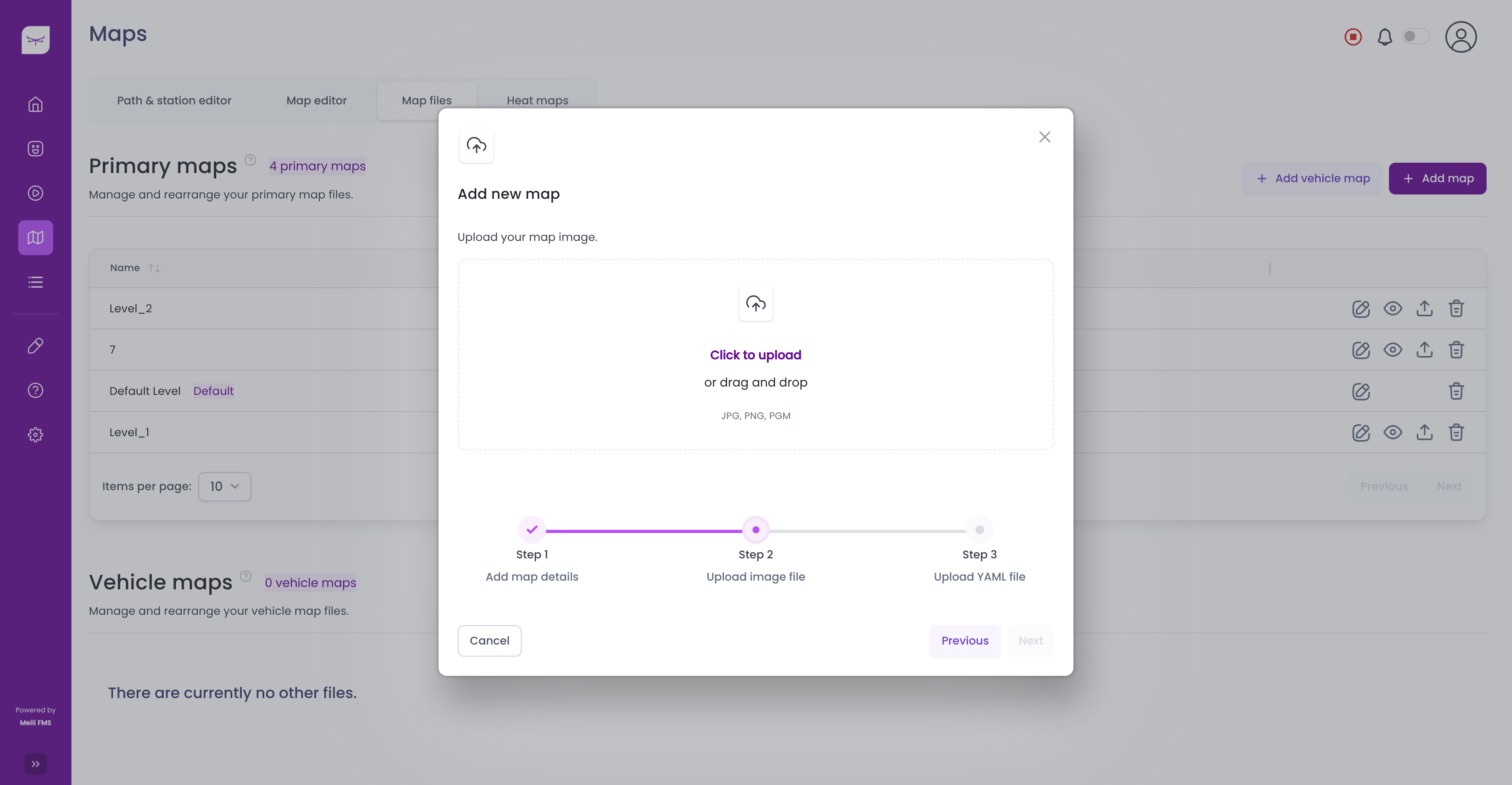
Step 2 – Upload the map image #
Upload the occupancy grid map image by clicking Click to upload or by dragging and dropping the file into the upload area.
The supported image formats are:
- PNG
- PGM
- JPEG
After the image has been uploaded, a preview of the map is displayed. Click Next to continue.
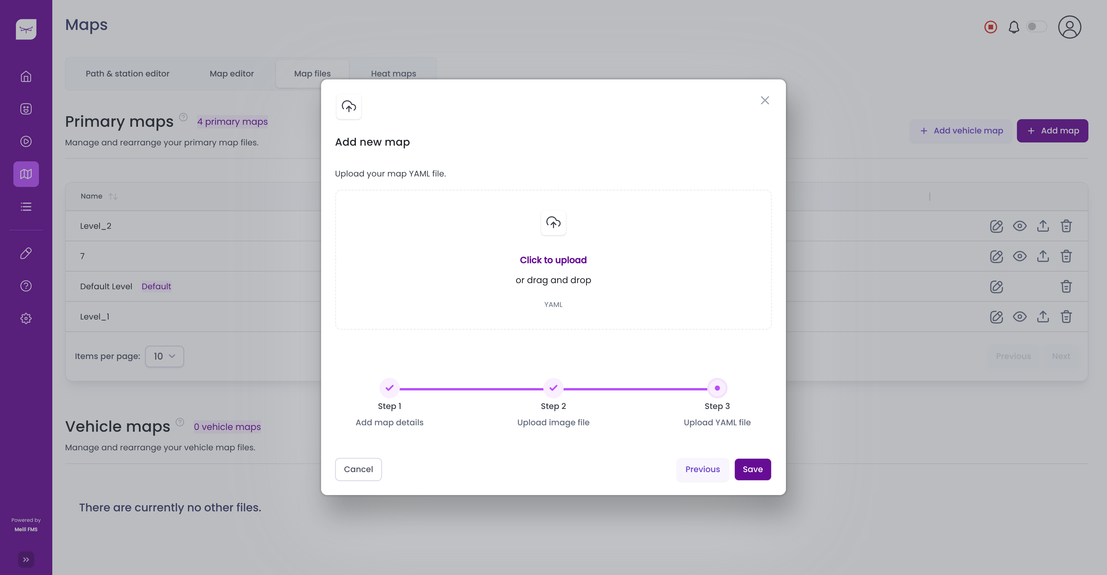
Step 3 – Upload the metadata #
Upload the corresponding YAML metadata file by clicking Click to upload or by dragging and dropping the file into the upload area.
The YAML file contains the occupancy grid parameters associated with the map image.
After the upload is complete, click Save.
The uploaded map will appear in the Primary maps list, where it can be previewed, edited, downloaded, or deleted.
Next steps #
After uploading a map, you can continue with the following tasks:
- Learn how to modify your map in the Map Editor.
- Learn how to add stations and paths in Path & station editor.
- Read the Map Format Description to learn more about the supported map formats.
- Download sample map files.